Using
the example of our Manhattan title, a tutorial about the technology
is presented below. This example may also be downloaded in a PDF
file here.
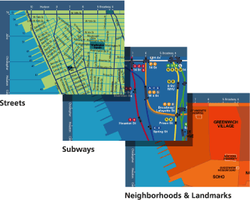
Artwork for three views of Manhattan is created and optimized
for visual performance.
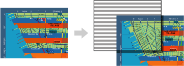
Images are interlaced by alternating horizontal strips from each.
The resulting compound image is calibrated to a specially designed
polymer lens substrate. Lenses contain between 60 to 200 micro-lenses
per inch, depending on the desired outcome. This is mounted to
a backing, finished and packaged.
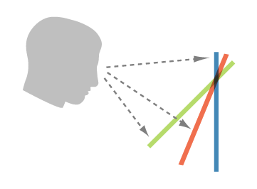
The underlying technology essentially fools the human eye. By
rotating the map, the angle of viewing is changed and one of the
resulting three layers can be viewed. A
Flash demo may be viewed here. |